 |
|
65 D-L Hendersonville
|
 |
Contributors Photos |
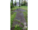
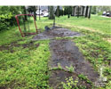
Photos contributed by Greg Miyake and Sarah Kim on July 22, 2019 |
PRIVATE RESIDENCE DO NOT TRESPASS!
 |
Click on small photo to view it larger
     |
Location / Airway |
Location / Name
TENNESSEE: Wilson County
PRIVATE RESIDENCE FOR INFORMATION ONLY! DO NOT TRESPASS!
65 D-L Hendersonville, beacon station site No. 65 on the Dallas-Louisville Airway
GPS: 36.279004, -86.553375
Air Mail (A.M. Route #)
December 31, 1931
A.M. #20 (A.M. #16 Consolidated with A.M. #20 effective June 1, 1931)
New York, N.Y., via Albany, Schenectady, Utica, Rome, Syracuse, Rochester and Buffalo, N. Y.; Cleveland, Akron, Columbus, Dayton and Cincinnati, Ohio; Louisville, Ky.; Nashville and Memphis, Tenn.; Little Rock, Ark.; Texarkana, Ark., Tex., and Dallas, Tex., to Fort Worth, Tex., and return.
American Airways Inc.
September 1, 1932
A.M. #20 New York-Ft. Worth
Dallas to Louisville Airway
Nashville to Louisville Section
American Airways Inc.
1933
A.M. #20 New York-Cleveland-Ft. Worth
New York to Fort Worth, Tex ., via Albany, Buffalo, Cleveland, Cincinnati, Memphis, Little Rock and Dallas
American Airways In.
February 19, 1934
All domestic air mail contracts were canceled, effective at midnight, February 19, 1934. From that date the air mail was carried by the Army Air Corps up to the time service was resumed by private operators under temporary contracts. Service was suspended during the
period of March 12 to March 18 (inclusive), 1934.
Army Air Corps
June 10, 1934
A.M. #23 Newark, N. J, to Fort Worth, Texas.,
Nashville-Ft. Worth (To American Airlines, Inc)
July 1, 1934
A.M. #23 Newark, N. J, to Fort Worth, Texas.
Nashville-Newark (To American Airlines, Inc)
January 1, 1935
A. M. #23 Newark, N. J, to Fort Worth, Texas.
American Airlines Inc.
1936
Civil Airway No. 26, Dallas-Louisville
Dallas, Texas, Love Field, Municipal Airport; via Texarkana, Ark., Municipal Airport; Little Rock, Ark., Municipal Airport; Memphis, Tenn., Municipal Airport; Nashville, Tenn., Municipal Airport; to Louisville, Ky., Bowman Field.
American Airlines Inc.
Operator
American Airways Inc. 1931-1934
American Airlines Inc. 1934
|
Observations and Notes |
April 10, 2018
Jeff Stein reported that he had located the arrow at someone's private residence. Please do not trespass.
July 22, 2019 Greg Miyake posted to Facebook:
Fortunately we were able to catch the owner of the property where this arrow resides while he was working outside. He graciously allowed us into his backyard to take some photos and showed us a printout of the only information he could find online about the Hendersonville arrow. From what we saw, the arrow appeared to be in good condition - no notable deterioration or major cracks, just covered in fallen twigs and leaves. Unfortunately it is being used as level ground for various sports equipment. Had we not caught the owner outside, I could see him being a bit perturbed with an uninvited guest requesting permission to roam around his backyard.
|
Links |
Described by Coast and Geodetic Survey 1933 (GLA)
A 24-inch beacon on 87-foot steel tower on knob overlooking Cumberland River Valley. To reach from community house at Old Hickory, go east and south (following signs to Hermitage) 2.9 miles to Andrew Jackson School, continue east 3 miles on paved road (Rabbit Lane), turn north onto country road and go 0.65 mile, turn northwest, go 2.6 miles to two letter boxes, turn northeast, go 0.5 mile to forks, turn right, go 0.2 mile up bed of stream, turn left leaving stream, go 0.5 mile, turn left, pass through gate, and go 0.2 mile to Sewell’s house, near beacon site.
Air Commerce Bulletin Vol. 03 No. 20, page 511, April 15, 1932
Site No. 65: 4 miles southeast of Hendersonville, Tenn. Course light characteristic: dot, dash, dot (. _ .). (Dallas-Louisville Airway (Nashville- Louisville section).—Clear 24-Inch 1,000,000-candlepower rotating airway beacon lights showing 6 flashes per minute and red course lights are in operation at the following sites on the Dallas-Louisville Airway).
 Wed, Mar 26, 1986 – Page 57 · The Tennessean (Nashville, Davidson, Tennessee, United States of America) · Newspapers.com Wed, Mar 26, 1986 – Page 57 · The Tennessean (Nashville, Davidson, Tennessee, United States of America) · Newspapers.com
1932 Air Corps Map No. 48; Louisville, KY to Nashville, TN; (Experimental)
Compiled and printed by the Information Division, Office Chief of Air Corps, at the Engineer Reproduction Plant, U.S. Army, Washington, D.C.
Portion of 1932 Air Corps Map No. 48; Louisville, KY to Nashville, TN; (Experimental)
1934 Air Corps Map No. 49; Nashville, Tenn. to Birmingham, Ala.; (Experimental)
Compiled and printed by the Information Division, Office Chief of Air Corps, at the Engineer Reproduction Plant, U.S. Army, Washington, D.C.
1935 Nashville Sectional Aeronautical Chart
Compiled and printed for the Bureau of Air Commerce of the Department of Commerce by the Coast and Geodetic Survey Washington, D.C.
Portion of 1935 Nashville Sectional Aeronautical Chart

|
|
Make a comment on our Facebook Page "Arrows Across America" about this arrow.

|
Previous Beacon Site |
|
Next Beacon Site |
|
Alabama | Arizona | Arkansas | California | Colorado | Connecticut | Delaware | Florida | Georgia | Idaho | Illinois | Indiana | Iowa | Kansas
Kentucky | Louisiana | Maine | Maryland | Massachusetts | Michigan | Minnesota | Mississippi | Missouri | Montana | Nebraska | Nevada
New Hampshire | New Jersey | New Mexico | New York | North Carolina | North Dakota | Ohio | Oklahoma | Oregon | Pennsylvania
Rhode Island | South Carolina | South Dakota | Tennessee | Texas | Utah | Vermont | Virginia | Washington | West Virginia | Wisconsin | Wyoming |
|


