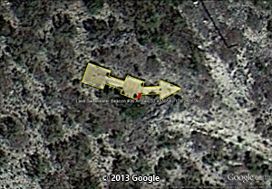
Ables
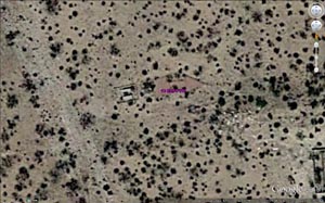
Department of Commerce Intermediate field. Site 8A El Paso-Fort Worth Airway. Ninety miles E. of El Paso. Altitude 4,500 feet. L shape, 96 acres, sandy, level, natural drainage; two landing strips, 3,000 by 55O feet, N./S., 3,960 by 550 feet E./W. Directional arrow marked "8A El P-Ft. W." Pole line along road to S. Beacon, boundary, approach lights. Beacon, 36-inch rotating, showing alternate green and white flashes. No servicing facilities.
Department of Commerce intermediate field, site 8A, El Paso-Fort Worth Airway. Ninety miles E. of El Paso. Altitude 4,500 feet. L shape, 96 acres; sandy, level; natural drainage; two landing strips, 3,000 by 550 feet, N./S., 3,960 by 550 feet E./W. Directional arrow marked "8A El P-Ft. W." Pole line along road to S. Beacon, boundary, approach lights. Beacon, 36-inch rotating, showing alternate green and white flashes. No servicing facilities.
|
Adrian
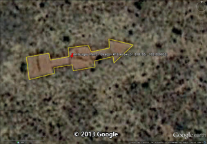
Department of Commerce Intermediate field, site 91, Los Angeles-Amarillo Airway. Three miles S. Altitude 3,500 feet. L shape, 150 acres, sod, level, natural drainage; three landing strips, 3,830 feet N./S., 3,630 feet E./W., and 4,000 feet NE./SW. Windmill and house to NE. Directional arrow marked "91 LA-A." Beacon, boundary, and approach lights. Beacon, 36-inch rotating, showing alternate clear and green flashes. No servicing facilities.
Department of Commerce Intermediate field, site 91, Los Angeles-Amarillo Airway. Three miles S. Altitude 3,500 feet. L shape, 150 acres: sod, level; natural drainage; three landing strips 3,830 feet N./S., 3,630 feet E./W., and 3,830 feet NE./SW. Windmill and house to NE. Directional arrow marked "91 LA-A." Beacon, boundary, and approach lights. Beacon, 36-inch rotating, showing alternate clear and green flashes. No servicing facilities.
|
Baird
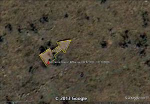
Department of Commerce Intermediate field, site 42 EL Paso-Fort Worth Airway. One and one-half miles N. of town. Altitude, 1,708 feet. Irregular, 86 acres, 2,400 by 2,550 feet, clay and sand, level, natural drainage, entire field available except NE. corner. Directional arrow marked "42 ELP- FTW." Pole line and trees to W., fence to N. and S., deep gully in NE. corner. Beacon and boundary lights. Beacon, 24-inch, rotating green. No servicing facilities.
Department of Commerce intermediate field, site 42, El Paso-Fort Worth Airway. One and one-half miles N. of town. Altitude, 1,708 feet. Irregular, 86 acres, 2,400 by 2,550 feet; clay and sand, level; natural drainage; entire field available except to NE. corner. Directional arrow marked " 42 El P- Ft W." Pole line and trees to W., fence to N. and S„ deep gully in NE. corner. Beacon and boundary lights. Beacon, 24-lnch, rotating, green. No servicing facilities
|
Belton
Department of Commerce intermediate field, site 39, Brownsville-Fort Worth Airway. One-quarter mile S. Altitude, 511 feet. L shape, 100 acres, sod, level, natural and tile drainage; two landing strips, 3,250 feet N./S. and 1,885 feet E./W. Directional arrow marked "39 B-FTW." Beacon tower in NW. corner; pole line to NE. and N. Beacon, boundary, approach, and obstruction lights. Beacon, 24-inch rotating with green course lights flashing characteristic "9" ( .). No servicing facilities.
Department of Commerce intermediate field, site 39, Brownsville-Fort Worth Airway. One-quarter mile S. Altitude, 511 feet. L shape, 100 acres, sod, level, natural and artificial drainage; two landing strips, 3,250 feet N./S. and 1,865 feet E./W. Directional arrow marked "39 B-FTW." Beacon tower in NW. corner; pole line to NE. and N. Beacon, boundary, approach, and obstruction lights. Beacon, 24-inch rotating, with green course lights flashing characteristic "9" ( .). No servicing facilities.
|
Campbellton
Department of Commerce intermediate field, site 21, Brownsville-Fort Worth Airway. At city limits, on W. Altitude, 400 feet. Irregular, 72 acres, sand and grass, level, natural and tile drainage; one landing strip, 2,200 feet N./S.; entire field available. Directional arrow marked "21 B-FTW." Pole line on N. and E., beacon tower to NE., windmill to NW. Beacon, boundary, approach, and obstruction lights. Beacon, 24-Inch rotating, with green course lights flashing characteristic " 1" (. ) No servicing facilities.
Department of Commerce intermediate field, site 21, Brownsville-Fort Worth Airway. At city limits, on W. Altitude, 400 feet. Irregular. 72 acres, sand and grass, level, natural and artificial drainage; one landing strip, 2,200 feet N./S.; entire field available. Directional arrow marked " 21 B-FTW." Pole line on N. and E., beacon tower to NE., windmill to NW. Beacon, approach, and obstruction lights. Beacon, 24-inch rotating with green course lights flashing characteristic "1" (. ). No servicing facilities. Field in bad condition, should be used for emergency landings only.
|
Canadian
Department of Commerce intermediate field, site 9, Amarillo-Kansas City Airway. Seven miles N. of Canadian. Altitude, 2,601 feet T shape, 90 acres, sod, level, natural drainage; three landing strips, 3,550 by 570 feet N./S. 2,140 by 515 feet E./W. 2,210 feet NE./SW. Directional arrow marked "9 A-KC." Beacon, boundary, and obstruction lights. Beacon, 24-inch rotating, with green course lights flashing characteristic "9" (—_.). No servicing facilities.
|
Cleburne
Department of Commerce intermediate field, site 48, Brownsville-Ft. Worth Airway. Six and one-half miles NE. Altitude, 800 feet. Irregular, 83 acres, surface, sod, level, natural drainage; two landing strips, 2,140 by 897 feet N./S. and 2.640 by 800 feet NE./SW. Directional arrow marked "48 B-FTW." Buildings to NE., NW, and W.; pole lines to E., W., and S.; trees and beacon tower to W. Beacon, boundary, approach, and obstruction lights, Beacon, 24-Inch rotating, with green course lights flashing characteristic "8" (_. . .). No servicing facilities.
Department of Commerce intermediate field, site 48, Brownsville-Ft. Worth Airway. Six and one-half miles NE. Altitude, 800 feet. Irregular, 83 acres, surface, sod, level, natural drainage; two landing strips, 2,180 by 897 feet N./S. and 2,640 by 800 feet NE./SW. Directional arrow marked "48 B.-FTW." Buildings to NE., NW., and W.; pole lines to E., W., and S.; trees and beacon tower to W. Beacon, boundary, approach, and obstruction lights. Beacon, 24-inch rotating, with green course lights flashing characteristic "8" (_...). No servicing facilities.
|
Eastland
Department of Commerce Intermediate field, site 45B, El Paso-Fort Worth Airway. One mile N. Altitude, 1,421 feet. Irregular, 100 acres, sandy clay, level, natural drainage; one landing strip, 3,400 by 2,250. Directional arrow marked "45B ELP-FTW." Pole line to NW, bluff to W., draw to E. Beacon, boundary, and approach lights. Beacon, green, flashing characteristic "5" (. — .) No servicing facilities.
Department of Commerce intermediate field, site 45B, El Paso-Port Worth Airway. One mile N. Altitude, 1,421 feet. Irregular, 100 acres, sandy clay, level, natural drainage; one landing strip, 3,400 by 2,250. Directional arrow marked "45B ELP-FTW." Pole line to NW., bluff to W., draw to E. Beacon, boundary, and approach lights. Beacon, green, flashing characteristic "5" (. .). No servicing facilities.
|
Ganado
Department of Commerce intermediate field, site 25, Brownsville-Houston Airway. One and five-tenths miles N. of city. Altitude, 71 feet. Irregular, 100 acres, sod, level, natural and tile drainage; two landing strips, N./S. and E./W., 2,550 feet; entire field available. Directional arrow marked "25 B-H." Trees, pole line, and beacon tower to SW. Beacon, boundary, approach, and obstruction lights. Beacon, 24-inch rotating, with green course lights flashing characteristic "5" (._.). No servicing facilities.
Department of Commerce intermediate field, site 25, Brownsville-Houston Airway (day field only). One and one-half miles N. of city. Altitude, 71 feet. Irregular, 100 acres, sod, level, natural and artificial drainage; two landing strips, N./S. and E./W., 2,550 feet; entire field available. Directional arrow marked "25 B-H." Trees, pole line, and beacon tower to SW. No servicing facilities.
|
George West
Department of Commerce intermediate field, site 18, Brownsville-Fort Worth Airway. Two and one-half miles N. Altitude, 300 feet. Irregular, 74 acres, sod, level, natural and tile drainage; two landing strips, 2,200 feet N./S. and E./W. Directional arrow marked "19 B-Ft. W." Beacon tower on S., windmill to NE. Beacon, boundary, approach, and obstruction lights. Beacon, 24-Inch rotating, with green course lights flashing characteristic "8" (_...). No servicing facilities.
Department of Commerce intermediate field, site 18, Brownsville-Fort Worth Airway. Two and one-half miles N. Altitude, 300 feet Irregular, 74 acres, sod, level, natural and artificial drainage: two landing strips, 2,200 feet NE./SW. and NW./SE. Directional arrow marked "18 B-Ft. W." Beacon tower on S., windmill to NE. Beacon, boundary, approach, and obstruction lights. Beacon, 24-inch rotating, with green course lights flashing characteristic "8" (— . . .)• No servicing facilities.
|
Glazier
Department of Commerce intermediate field, site 9B, Amarillo-Kansas City Airway. Seven and one-half miles N. Altitude, 2,601 feet. L shape, 90 acres, sod, level, natural drainage; two landing strips, 2,790 by 620 feet N./S., 2,160 by 615 feet B./W. Directional arrow marked "9B AM-KC." Beacon, boundary, and approach lights. Beacon, 24 inch rotating, with green course lights flashing characteristic "9" ( .) No servicing facilities. Field under construction.
|
Guadalupe
Department of Commerce intermediate field, site 11, El Paso-Fort Worth Airway. One hundred and ten miles E. of El Paso. Altitude, 4,500 feet. Cross shape, 86 acres, dirt, level, natural drainage; two landing strips. NW./SB. 2,700 by 550 feet, NB./SW. 3,960 by 550 feet. Directional arrow marked "11 El P-Ft W." Pole line to S. Beacon, boundary, and approach lights. Beacon, 36-inch rotating, showing alternate green and white flashes. No servicing facilities. (*note: also known as Diamond Springs, and Cow Mountain)
Department of Commerce intermediate field, site 11, El Paso-Fort Worth Airway. One hundred and ten miles E. of El Paso. Altitude, 4,500 feet. Cross shape, 86 acres, dirt, level, natural drainage; two landing strips, NW./SE. 2,700 by 550 feet, NE./SW. 3,960 by 550 feet. Directional arrow marked "11 El P-Ft. W." Pole line to S. Beacon, boundary, and approach lights. Beacon, 36-inch rotating, showing alternate green and white flashes. No servicing facilities.
|
Hawkins
Department of Commerce intermediate field (day field only), site 12, Fort Worth-Atlanta Airway. Six miles NW. Altitude. 394 feet. Irregular, sod, level, natural drainage; three landing strips, 2,732 by 600 feet N./S., 2,710 by 660 feet E./W., 2,850 by 600 feet NW./SE. Directional arrow marked "12 FTW-A." Fence to E. and W. No servicing facilities.
Department of Commerce intermediate field (day field only), site 12, Fort Worth-Atlanta Airway. Six miles NW. Altitude, 394 feet. Irregular, 91 acres, sod, level, natural drainage; three landing strips, 2,640 by 600 feet N./S., 2,700 by 500 feet E./W., 2,850 by 600 feet NW./SE. Directional arrow marked "12 Ft. W-A." Fence to E. and W. No servicing facilities.
|
Highway
Department of Commerce intermediate field, site 1, El Paso-Fort Worth Airway. Twenty miles E. of El Paso. Altitude, 4,000 feet. L shape, 96 acres, dirt, level, natural drainage; two landing strips, 3,000 by 500 feet N:/S., 8,960 by 550 feet E./W. Directional arrow marked "1 ELP-FTW" Beacon, boundary, and approach lights. Beacon, 36-inch rotating, showing alternate green and white flashes. No servicing facilities.
|
Hudspeth
Department of Commerce intermediate field, site 4, El Paso-Fort Worth Airway. Fifty miles E. of El Paso. Altitude, 4,500 feet. L shape, 96 acres, dirt, level, natural drainage; two landing strips, 3,000 by 550 feet N/S., 3,960 by 550 feet E./W. Directional arrow marked "4 ELP-FTW" Beacon, boundary, and approach lights. Beacon, 36-inch rotating, showing alternate green and white flashes. No servicing facilities.
Department of Commerce intermediate field, site 4, El Paso-Fort Worth Airway. Fifty miles E. of El Paso. Altitude, 4,500 feet. L shape, 96 acres, sand, level, natural drainage; two landing strips, 2,950 by 550 feet N./S., 3,960 by 550 feet E./W. Directional arrow marked "4 ELP-FTW." Beacon, boundary, and approach lights. Beacon, 36-inch rotating, showing alternate green and white flashes. No servicing facilities.
|
Kingsville
Department of Commerce intermediate field, site 11, Brownsville-Houston Airway. Two and one-half miles S of city. Altitude, 100 feet. L shape, 75 acres, sod, level, natural and tile drainage; two landing strips, 2.220 feet N./S. and 2,770 feet NW./SE.; entire field available. Directional arrow marked “11 B-H." Beacon tower in SW. corner. Beacon, boundary, approach, and obstruction lights. Beacon, 24-Inch rotating, with green course lights flashing characteristic "1" (. ). No servicing facilities.
Department of Commerce intermediate field, site 11, Brownsville-Houston Airway. Two and one-half miles S. of city. Altitude, 100 feet. L shape, 75 acres, sod, level, natural and artificial drainage; two landing strips, 2,220 feet N./S. and 2,770 feet NW./SE.; entire field available. Directional arrow marked "11 B-H." Beacon tower in SW. corner. Beacon, boundary, approach, and obstruction lights. Beacon, 24-inch rotating, with green course lights flashing characteristic "1" (. ). No servicing facilities.
|
Krum
Department of Commerce Intermediate field, site 2, Fort Worth-Wichita Airway. Two miles SW. Altitude, 725 feet. Rectangular, 125 acres, 2,151 by 1,360 feet N./S., 1,360 by 1,030 to 1,360 feet E./W. Directional arrow marked "2 FTW-W." Beacon, boundary, and approach lights. Beacon, 24 Inch rotating, with green course lights flashing characteristic "2" (. . —). No servicing facilities.
Department of Commerce intermediate field, site 2, Fort Worth-Wichita Airway. Two miles SW. Altitude, 725 feet. Rectangular, 125 acres, 2,010 by 3,150 feet, sod, level, natural drainage; two landing strips, 3,151 feet N./S., 2,600 feet NE./SW.; entire field available. Directional arrow marked "2 Ft. W-W." Beacon, boundary, and approach lights. Beacon, 24-inch rotating, with green course lights flashing characteristic "2" (. . —). No servicing facilities.
Name: Site No. 6, Dallas-Kansas City Airway (D-KC).
Class: Intermediate. Rating, . Owner, C. S. Wilkins, Denton, Tex.; operator, Department of Commerce. Caretaker, Emory S. Wilkins, Denton, Tex.
Position: Lat. 33° 14' 12": long. 97° 12' 49"; alt. above sea level, 900'; mag. var., 9° 30 E., 1927; annual change, zero. Distance and direction from city, 8 miles W. (269°) from Krum, Tex.; 14 ½ miles W. (277°) from Denton, Tex.
Description: Size, 1,500' x 500' E. and W.; 1,980' x 500' N. and S.; acres, approx. 30; shape, L. Surface, sod; gradient, slope to E.; drainage, natural. Landing strips, none; whole field available. Marking thereof, green lights indicate best
Obstructions: Low trees in slight valley on NW.; low ground to E. Marking (day), none. Lighting, none.
Marking and identification: Standard 50' white circle, in NW. section, with arms indicating approaches. Name on hangar or in field, none. Other marking, 6 D-KC on power house; illuminated directional arrow at beacon. Wind-direction indicator, illuminated cone on beacon tower.
Lighting: Beacon, NW. corner, 24" revolving, 6 r. p. m., 2,000,000 c p. Boundary lights, white, on 3' standards. Approach lights, green, indicating approaches. Flood lights for landing, none. Other lighting, none.
Accommodations: Personnel for servicing, none. Landing fee, none; storage, none. Hangars, none. Repair facilities, at Krum and Denton; spares, none. Specification fuel and oil, at Krum. Guard, caretaker; fire apparatus, extinguishers in power house. Quarters, in city; meals, in city, Transportation to city, none. First aid, none. Mooring mast, none.
Communication- and signal equipment: Telephone, in city; telegraph, in city. Radio, none.
|
Merkel
Department of Commerce intermediate field, site 38, El Paso-Fort Worth Airway. Just W. of town. Altitude, 1,872 feet. L shape, 78 acres, sod, level, natural drainage; two landing strips, 2,616 by 660 feet N./S., 2,640 by 660 feet, E./W. Directional arrow marked "38 ELP-FTW." Pole lines to S. and W., windmill to SW. and NW., fence to N. Beacon, boundary, and approach lights. Beacon, 24-inch rotating, green. No servicing facilities.
Department of Commerce Intermediate field, site 38, El Paso-Fort Worth Airway. Just W. of town. Altitude. 1,872 feet. L shape, 78 acres, sod. level, natural drainage; two landing strips, 2,616 by 660 feet N./S., 2.640 by 660 feet, E./W. Directional arrow marked "38 EIP-FTW." Pole lines to S. and W., windmill to SW. and NW., fence to N. Beacon, boundary, and approach lights. Beacon, 24-inch rotating, green. No servicing facilities.
|
Muenster
Name: Site 9, Dallas-Kansas City Airway (D-KC).
Class: Intermediate. Rating. Owner, Mrs. John Knauf, Route No. 1, Muenster, Tex.; operator, Department of Commerce. Caretaker, Alex. Knauf, Route No. 1, Muenster.
Position: Lat. 33° 42' 55"; long. 97° 20' 45"; alt. above sea level, 1100' ; mag. var. 9° 33' E. (1927) : annual change, zero. Distance find direction from city, 6 miles NW. (322° true) from Muenster.
Description: Size 984' x 1,800'; acres, 35; shape, rectangular. Surface, sod; gradient, level; drainage, good, natural. Landing strips or runways, none; whole field available.
Obstructions: Telephone-pole line, 12', along S. boundary. Marking (day), none. Lighting, red boundary lights, flashing, 80-120 times a min.
Marking and identification: Standard 50' white circle, yes, with arms indicating best approaches. Name on hangar or in field, none. Other marking, " 9 D-KC" on roof of power house; illuminated arrow at beacon. Wind direction indicator, illuminated, on beacon tower.
Lighting: Beacon, SW. corner, 24" rotating, 6 r. p. m., 2,000,000 c. p. Boundary lights, white, on 3' standards. Approach lights, one green at N. end. Flood lights for landing, none. Other lighting, none.
Accommodations: Personnel for servicing, none. Landing fee, none; storage, none. Hangars, none. Repair facilities, none; spares, none. Specification fuel and oil, none. Guard, caretaker; fire apparatus, hand extinguisher in power house. Quarters, in city; meals, in city. Transportation to city, none. First aid, none. Mooring mast, none.
Communication and signal equipment: Telephone, at caretaker's; telegraph, in city. Radio, none.
Remarks: Lighting system operated all night.
|
Odessa
Department of Commerce Intermediate field, site 22, El Paso-Fort Worth Airway. Eighteen miles NW. of Odessa, seventy miles W. of Big Spring, Texas. Altitude, 2,890 feet. L shape, dirt, level, natural drainage; two landing strips, 3,420 by 552 feet N./S., 3,960 by 560 feet E./W. Directional arrow marked "22 ELP-FTW." Pole line to S., fence to E. Beacon, boundary, and approach lights. Beacon, 36-inch rotating, showing alternate green and white flashes. No servicing facilities
Department of Commerce intermediate field, site 22, El Paso-Fort Worth Airway. Seventeen miles W. of Odessa, seventy miles W. of Big Spring, Tex. Altitude, 2,890 feet. L shape, dirt, level, natural drainage; two landing strips, 3,420 by 552 feet N./S., 3,960 by 560 feet E./W. Directional arrow marked "22 ELP-FTW." Pole line to S., fence to E. Beacon, boundary, and approach lights. Beacon, 36-inch rotating, showing alternate green and white flashes. No servicing facilities.
|
Orla
Department of Commerce intermediate field, site 14, El Paso-Fort Worth Airway. One hundred and forty miles E. of El Paso. Altitude, 4,000 feet. T shape, 100 acres, dirt, level, natural drainage; two landing strips, 3,000 by 550 feet N./S., 3,960 by 550 feet E./W. Directional arrow marked "14 ELP-FTW." Pole line to S., fence to E., stony ridge to E. and W., hill to W. Beacon, boundary, and approach lights. Beacon, 36-inch rotating, showing alternate green and white flashes. No serving facilities.
Department of Commerce intermediate field, site 14, El Paso-Fort Worth Airway. Thirteen and one-half miles W. of Orla, one hundred and forty miles E. of El Paso. Altitude, 4,000 feet. T shape, 110 acres, dirt, level, natural drainage; two landing strips, 3,000 by 550 feet N./S., 3,460 by 550 feet E./W. Directional arrow marked "14 ELP-FTW." Pole line to S., fence to E., stony ridge to E. and W., hill to W. Beacon, boundary, and approach lights. Bea- con, 36-inch rotating, showing alternate green and white flashes. No servicing facilities.
|
Peoria
Department of Commerce intermediate field, site 45, Brownsville-Fort Worth Airway. One-quarter mile NE. Irregular, 69 acres, sod, level, natural drainage; landing strips, 2,150 feet N./S., 2,100 feet NB./SW. and NW./SE. Directional arrow marked "45 B-Ft. W." Beacon, boundary, and obstruction lights. Beacon, 24-inch rotating, with green course lights flashing characteristic "5" (._.). No servicing facilities.
Department of Commerce intermediate field, site 45, Brownsville-Fort Worth Airway. One-quarter mile NE. Irregular, 69 acres, sort, level, natural drainage; landing strips, 2.150 feet N./S., 2,100 feet E./W. and 1.650 feet NW./SE. Directional arrow marked "45 B-Ft W." Beacon, boundary, and obstruction lights. Beacon, 24-inch rotating, with green course lights flashing: characteristic "5" (._.). No servicing facilities.
|
Pierce
Department of Commerce intermediate field, site 29, Brownsville-Houston Airway. One-quarter mile SE. of city. Altitude, 109 feet. Irregular, 87 acres, 2,560 by 2,865 by 1,940 feet, sod, level, natural and tile drainage; entire field available. Directional arrow marked "29 B-H." Beacon tower in N. corner of field. Beacon, boundary, approach, and obstruction lights. Beacon, 24-inch rotating, with green course lights flashing characteristic "9" ( .). No servicing facilities.
Department of Commerce intermediate Field, site 28, Brownsville-Houston Airway (day field only). One quarter mile SE. of city. Altitude. 109 feet. Irregular, 87 acres, 2,560 by 2,865 by 1,940 feet, sod, level, natural and artificial drainage; entire field available. Directional arrow marked "28 B-H." Beacon tower in N. corner of field. No servicing facilities.
|
Porterville
Department of Commerce intermediate field, site 16, El Paso-Fort Worth Airway. One hundred and sixty miles E. of El Paso, 22 miles W. of Wink. Altitude 4,500 feet. L shape, 96 acres, loose rock and sand surface, natural drainage; two landing strips, 3.000 by 550 feet N./S., 3,960 by 550 feet E./W. Directional arrow marked "16 ELP-FTW" Pole line to S. Beacon, boundary, and approach lights. Beacon, 36-Inch rotating, showing alternate green and white flashes. No servicing facilities.
Department of Commerce intermediate field, site 16, El Paso-Fort Worth Airway. Eight and one-half miles N. of Porterville, 160 miles E. of El Paso, 22 miles W. of Wink. Altitude 4,500 feet. L shape, 96 acres, loose rock and sand surface, natural drainage; two landing strips, 3,000 by 550 feet N./S., 3,960 by 550 feet E./W. Directional arrow marked "16 ELP- FTW." Pole line to S. Beacon, boundary, and approach lights. Beacon, 36- inch rotating, showing alternate green and white flashes. No servicing facilities.
|
Raymondsville
Department of Commerce intermediate field, site 5, Brownsville-Houston Airway. Three and one-half miles NE. of city. Altitude, 250 feet. L shape, 90 acres, sod, level, natural drainage; two landing strips, 2,640 feet N/S. and E./W.; sod, level, natural drainage; entire field available. Directional arrow marked "5 B-H." Beacon tower to SW. Beacon, boundary, and approach lights. Beacon, 24-inch rotating, with green course lights flashing characteristic "5" (. — .) No servicing facilities.
Department of Commerce intermediate field, site 5, Brownsville-Houston Airway. Three and one-half miles NE. of city. Altitude, 250 feet. L shape, 90 acres, sod, level, natural drainage; three landing strips, 2,640 feet N./S. and E./W.; 2,900 NW./SE.; sod, level, natural drainage; entire field available. Directional arrow marked "5 B-H." Beacon tower to SW. Beacon boundary, and approach lights. Beacon, 24-inch rotating, with green course lights flashing characteristic "5" (. — .). No servicing facilities.
|
Richmond
Department of Commerce intermediate field, site 31, Brownsville-Houston Airway. Twelve miles SE. Altitude, 104 feet. L shape, 60 acres, sod, level, natural and tile drainage; two landing strips, 2,828 by 500 feet, and 2,200 by 650 feet. Directional arrow marked "31 B-H." Beacon, boundary, approach, and obstruction lights. Beacon, 24-Inch rotating, with green course lights flashing characteristic "1" (. ). No servicing facilities.
Department of Commerce Intermediate field, site 31, Brownsville-Houston Airway (day field only). Twelve miles SE. Altitude, 104 feet. L shape, 60 acres, sod, level, natural and artificial drainage; two landing strips, 2,800 by 500 feet and 2,000 by 650 feet. Directional arrow marked "31 B-H." No servicing facilities.
|
San Benito
Department of Commerce intermediate field, site 2, Brownsville-Houston Airway. Adjoins city on E. Altitude, 33 feet. L shape. 100 acres, sod, level, natural drainage; two landing strips, 1,980 by 1,320 feet N./S., 2.640 by 1,320 feet E./W. Directional arrow marked "2 B-H." Beacon, boundary, and approach lights. Beacon, 24-inch rotating, with green course lights flashing characteristic "2" (. .—). No servicing facilities.
Department of Commerce intermediate field, site 2, Brownsville-Houston Airway. Adjoins city on E. Altitude, 33 feet. L shape, 100 acres, sod, level, natural drainage; two landing strips, 1,930 by 1,320 feet NB./SW., 2,840 by 1,230 feet NW./SE. Directional arrow marked "2 B-H." Beacon, boundary, and approach lights. Beacon, 24-inch rotating, with green course lights flashing characteristics "2" (. . —). No servicing facilities.
|
San Marcos
Department of Commerce intermediate field, site 30, Brownsville-Fort Worth Airway. Two and one-half miles SE. Altitude, 560 feet Irregular, 100 acres, 2,900 by 2,610 feet, sod, level, natural drainage; entire field available. Directional arrow marked "30 B-Ft. W." Trees, beacon tower, and windmill to N., pole in SW. corner. Beacon, boundary, approach, and obstruction lights. Beacon. 24-Inch rotating, with green course lights flashing characteristic "10" ( ). No servicing facilities.
Department of Commerce intermediate field, site 30, Brownsville-Fort Worth Airway. Two and one-half miles SE. Altitude, 560 feet Irregular, 100 acres, 2,900 by 2,610 feet, sod, level, natural drainage; entire field available. Directional arrow marked "30 B-FTW." Trees, beacon tower, and windmill to N., pole in SW. corner. Beacon, boundary, approach, and obstruction lights. Beacon, 24-Inch rotating, with green course lights flashing characteristic "10" ( )« No servicing facilities.
|
Santo
Department of Commerce intermediate field, site 48B, El Paso-Fort Worth Airway. One-half mile NW. T shape, 92 acres, sod, level, natural drainage; two landing strips, 2,500 by 660 feet, N./S., 3,116 by 700 feet E./W. Directional arrow marked "48B ELP-FTW" Fence to N. and E., ditch to E. Beacon, boundary, and approach lights. Beacon, green, flashing characteristic "8" ( . .). No servicing facilities.
Department of Commerce intermediate field, site 48B, El Paso-Fort Worth Airway. One-half mile NW. T shape, 92 acres, sod, level, natural drainage; two landing strips, 2,550 by 660 feet, N./S., 3,100 by 700 feet E./W Directional arrow marked "48 B ELP-Ft. W." Fence to N. and E., ditch to E Beacon, boundary, and approach lights. Beacon, green, flashing characteristic "8" (—. . .). Teletypewriter. Department of Commerce marker beacon characteristic signal "R" (._.), operating frequencies 350 and 278 kc. Kc servicing facilities.
|
Sinton
Department of Commerce Intermediate field, site 16, Brownsville-Houston Airway. Three-quarters mile E. of city. Altitude, 49 feet. Nearly square, 90 acres, 1,868 feet N/S., 2,100 feet E./W.; sod, level, natural and tile drainage; entire field available. Directional arrow marked "16 B-H." Beacon tower and pole line In SW. corner; water tower in NW. corner. Beacon, boundary, approach, and obstruction lights. Beacon, 24-inch rotating, with green course lights flashing characteristic "6" (_ . —). No servicing facilities.
Department of Commerce Intermediate field (day field only). Site 16, Brownsville-Houston Airway. Three-quarters mile E. of city. Altitude, 49 feet. Nearly square, 90 acres, 1,808 feet N./S., 2,100 feet E./W.; sod, level, natural and artificial drainage; entire field available. Directional arrow marked "16 B-H." Beacon tower and pole line in SW. corner; water tower in NW corner. No servicing facilities.
|
Stanton
Department of Commerce field, site 27, El Paso-Fort Worth Airway. North of town, fifteen miles W. of Big Springs, Square, 182 acres, 3,000 by 3,000 feet, dirt, level, natural drainage. Directional arrow marked "27 ELP-FTW." Pole line to E., fence to N. Beacon, boundary, and approach lights. Beacon, 36-inch rotating, showing alternate green and white flashes. No servicing facilities.
Department of Commerce Intermediate field, site 27, El Paso-Fort Worth Airway. Three miles NW. of town, 21 miles W. of Big Spring. L shape, 182 acres, dirt, level, natural drainage; two landing strips, 3,000 and 2,600 feet. Directional arrow marked "27 ELP-FTW." Pole line to E., fence to N. Beacon, boundary and approach lights. Beacon, 30-Inch rotating, showing alternate green and white flashes. No servicing facilities.
|
Turcotte
Department of Commerce Intermediate field, site 8B, Brownsville-Houston Airway. Three-quarters mile NW. of city. Altitude, 100 feet. Irregular. 80 acres, 1,900 by 2,100 feet, sod, level, natural drainage; entire field available. Directional arrow marked "8B, B-H." Beacon tower in SE. corner. Beacon and boundary lights. Beacon, 24-inch rotating, with green course lights flashing characteristic "8" (—.. . .) No servicing facilities.
Department of Commerce Intermediate field, site 8B, Brownsville-Houston Airway. Three-quarters mile NW. of city. Altitude, 100 feet. Rectangular, 85 acres, 1,900 by 2,100 feet, sod, level, natural drainage; entire field available. Directional arrow marked "8B, B-H." Beacon tower in SE. corner. Beacon and boundary lights. Beacon, 24-Inch rotating, with green course lights flashing characteristic "8" (_...)• No servicing facilities.
|
Victoria
Department of Commerce intermediate field, site 22, Brownsville-Houston Airway. Five and one-half miles NE. of city. Altitude 93 feet. Irregular, 105 acres, 2310 by 2,610 feet, sod, level, natural and tile drainage; entire field available. Directional arrow marked "22 B-B." Beacon tower is SE. corner; ditch on W. Beacon, boundary, and approach lights. Beacon, 24-inch with green course lights flashing characteristic "2" (.._). No servicing facilities.
Department of Commerce intermediate field, site 22, Brownsville-Houston Airway. Five and one-half miles NE. of city. Altitude 93 feet. Irregular, 100 acres, 2,310 by 2,610 feet, sod, level, natural and artificial drain-age; entire field available. Directional arrow marked "22 B-H." Beacon tower in SE. corner; ditch on W. No servicing facilities.
|
Viduari
Department of Commerce intermediate field, site 19, Brownsville-Houston Airway. One and one-half miles SW. of city. Altitude, 250 feet. V shape, 79 acres, 2,146 by 2,448 by 2,265 feet; entire field available. Directional arrow marked "19 B-H." Pole line and swamp on E.; beacon tower in NE corner. Beacon, boundary, and obstruction lights. Beacon, 24-inch rotating, with green course lights flashing characteristic "9" ( .) No servicing facilities.
Department of Commerce intermediate field, site 19, Brownsville-Houston Airway (day field only). One and one-half miles SW. of city. Altitude, 250 feet. Triangular, 79 acres, 2,146 by 2,488 by 2,965 feet; entire field available. Directional arrow marked "19 B-H." Pole line and swamp on E.; beacon tower in NE. corner. No servicing facilities.
|
Weatherford
Department of Commerce Intermediate field, site 51, El Paso-Fort Worth Airway. Four miles S. Altitude. 1.000 feet. Irregular, dirt, slightly rolling, natural drainage: two landing strips, 2,000 by 750 feet E./W. 1,500 by 500 NE./SW. Directional arrow marked "51 ELP-FTW." Fence to S. and W., trees to E. Beacon, boundary, and approach lights. Beacon, 24-inch rotating, with green course lights flashing characteristics "1" (. ). No servicing facilities.
|
Weir
Department of Commerce intermediate field, site 36, Brownsville-Ft. Worth Airway, 2 miles SE. Altitude, 700 feet. Irregular, 100 acres, 3,650 by 3,567 feet, sod, level, natural and tile drainage. Directional arrow marked "36 B-FTW." Beacon, boundary, approach, and obstruction lights. Beacon, 24-inch rotating, with green course lights flashing characteristic "6" (_ . ). No servicing facilities.
Department of Commerce intermediate field, site 36, Brownsville-Fort Worth Airway, 2 miles SE. Altitude, 700 feet Irregular, 100 acres, 2,650 by 3,567 feet, sod, level, natural and artificial drainage. Directional arrow marked "36 B-FTW." Beacon, boundary, approach, and obstruction lights. Beacon, 24-inch rotating, with green course lights flashing characteristic "6" ( ). No servicing facilities.
|
Westbrook
Department of Commerce intermediate field, site 32, El Paso-Fort Worth Airway. Adjoins city on S. Altitude, 2,127 feet. T shape, 134 acres, sod, level, natural drainage; two landing strips, 3,336 by 1,293 feet N./S. 2,600 by 1,000 feet E./W. Directional arrow marked "32 ELP-FTW" pole line to W., fence to S. and SE. Beacon, boundary, and approach lights. Beacon. 24-Inch rotating, green. No servicing facilities.
Department of Commerce intermediate field, site 32, El Paso-Fort Worth Airway. Adjoins city on S. Altitude, 2,127 feet. T shape, 134 acres, sod, level, natural drainage; two landing strips, 3,336 by 1,293 feet N./S- 2,570 by 1,000 feet E./W. Directional arrow marked "32 ELP-FTW." Pole line to W., fence to S. and SE. Beacon, boundary, and approach lights. Beacon, 24-inch rotating, green. No servicing facilities.
|
Wills Point
Department of Commerce intermediate field (day field only), site 7, Fort Worth-Atlanta Airway. Five and one-half miles NW. of city. Altitude, 532 feet. L shape, 128 acres, sod, level, natural drainage; three landing strips, 3,100 feet N./S., 3,000 feet NW./SE., 2,740 feet NE./SW. Directional arrow marked " 7 FTW.-A." Fence surrounds field, pole line to W. No servicing facilities.
Department of Commerce intermediate field (day field only), site 7, Fort Worth-Atlanta Airway. Five and one-half miles NW. of city Altitude, 532 feet. L shape, 128 acres, sod, level, natural drainage; three landing strips, 3,100 feet N./S., 3,000 feet NW./SE., 2,540 feet NE./SW. Directional arrow marked "7 FTW.-A." Fence surrounds field, pole line to W. No servicing facilities.
|
Wink
Department of Commerce intermediate field, site 18, El Paso-Fort Worth Airway. One hundred and eighty miles E. of El Paso. Altitude 3,500 feet. T shape, dirt, level, natural drainage; two landing strips, 3,000 by 060 feet N./S., 3,860 by 660 feet E./W. Directional arrow marked "18 ELP-FTW" Pole line to S. Beacon, boundary, and approach lights. Beacon, 36-inch rotating, showing alternate green and white flashes. No servicing facilities.
Department of Commerce intermediate field, site 18, El Paso-Fort Worth Airway. Four and one-half miles W. by N. of Wink, 180 miles E. of El Paso. Altitude, 3,500 feet. T shape, dirt, level, natural drainage; two landing strips, 3,000 by 660 feet N./S., 3,860 by 660 feet E./W. Directional arrow marked "18 ELP-FTW." Pole line to S. Beacon, boundary, and approach lights. Beacon, 36-inch rotating, showing alternate green and white flashes. No servicing facilities. Teletypewriter. Department of Commerce radio range beacon " S" (...), operating frequency 272 kc, under construction.
|
|