Detroit/Dearborn-Cleveland Airway |
This site provides historical information only, do not use for navigation purposes. |
 |
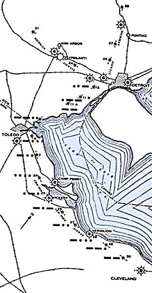
Cleveland-Detroit Airway
Sectional aeronautical charts: |
| SECTION MAP |
NAME |
GPS |
PID |
County, State |
 |
| Detroit City Airport / Coleman A. Young International Airport |
|
|
Wayne Co., Michigan |
| Ford Airport |
|
|
Wayne Co., Michigan |
| Wayne County Airport |
|
|
Wayne Co., Michigan |
| 12 C-D |
|
|
|
| 11B C-D |
|
|
|
| 11A C-D |
|
|
|
| 9 C-D |
|
|
|
| 8 C-D |
|
|
|
| Toledo |
|
|
|
| 7 C-D |
|
|
|
| 24 C-NY |
|
|
|
| Camp Perry |
|
|
|
| 25 C-NY |
|
|
|
| Vickery |
|
|
|
| 26 C-NY |
|
|
|
| 27 C-NY |
|
|
|
| 28 C-NY |
|
|
|
| 29 C-NY |
|
|
|
| 30 C-NY |
|
|
|
| Cleveland |
|
|
|
|
Links |
Cleveland-Detroit Airway Airway
Bulletin No. 1, September 1, 1932
|