National Geodetic Survey Data Sheet OZ1042
Described by Coast and Geodetic Survey 1959
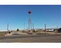
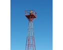
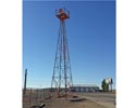
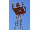
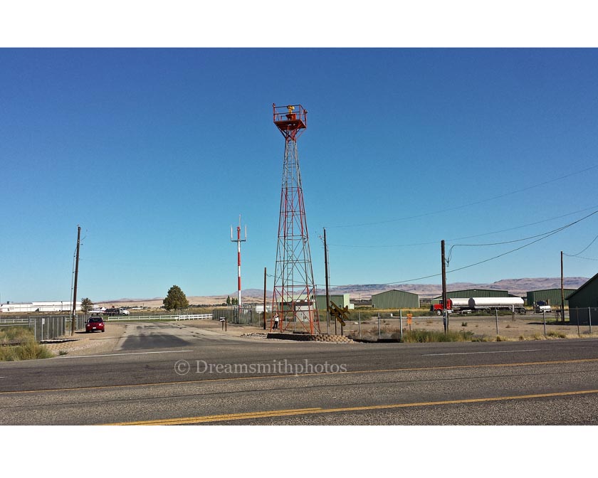
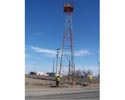
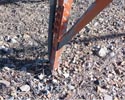
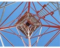
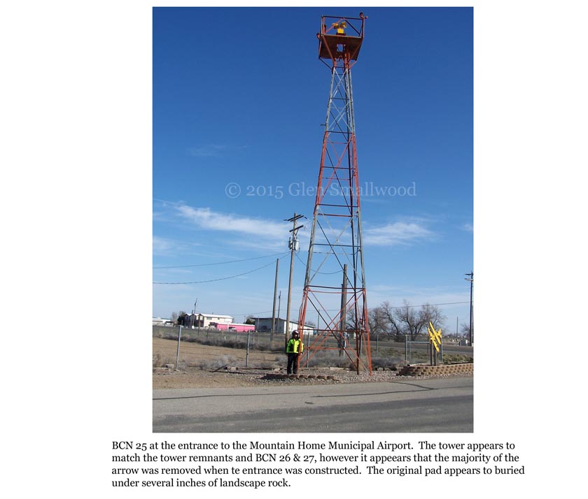
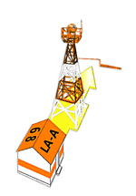
The airway beacon is a steel frame tower which is 55 feet high, is 9 feet square at the base. The center of the beacon was used.

| Description |
Date |
Link |
Has a map of the site on first page
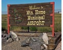
Page 2, MOUNTAIN HOME, IDAHO (REVISED) Name: Site No. 25, Salt Lake-Pasco Airway (SL-P).
Class: Intermediate. Rating. Owner, village of Mountain Home, Idaho; operator, Department of Commerce.
Position: Lat. 43° 08' 00", long. 115° 43' 37" ; alt. above sea level, 3,000'; mag. var. , 19° 30' E. , 1931; annual decrease, 2'. Distance and direction from city, 1½ miles W. of Mountain Home Idaho.
Description: Size, 2,640' x 2,640'; acres, 160; shape, square. Surface, sod; gradient, level; drainage, natural. Landing strips or runways, none; whole field available. Marking thereof, none. Obstructions: House, barn, and water tank to NW; beacon and power line in SE. corner; irrigation ditch to E.; fence on S. Marking (day), none. Lighting, red on power line.
Marking and identification: Standard 50' yellow circle, in center of field. Name on hangar or in field, none. Other marking, none. Wind-direction indicator, illuminated cone on beacon tower In SE corner.
Lighting: Beacon, 24" rotating, 6 r. p. m., 1,000,000 c. p., on tower. Boundary lights, surround field. Approach lights, 6 green, indicating best approaches. Flood lights for landing, none. Other lighting, none.
Accommodations: Personnel for servicing, none. Landing fee, none; storage, none. Hangar, none. Repair facilities, none; spares, none. Aviation fuel and oil, none. Guard, none; fire apparatus, none. Quarters, in city; meals, in city. Transportation to city, none. First aid, none. Mooring mast, none.
Communication and signal equipment; Telephone, none; telegraph, none. Radio, none. |
May 5, 1931 |
Airway Bulletin No. 716 |
| Mountain Home, Idaho page 40.—Department of Commerce intermediate field, site 25, Salt Lake-Pasco Airway. One and one-half miles W. of Mountain Home. Altitude, 3,000 feet. Square, 160 acres, 2,640 by 2,640 feet, sod, level, natural drainage; whole field available. Directional arrow marked "25 SL-P" Water tower to NW, beacon tower and pole line in SE. corner. Irrigation ditch on B. Beacon, boundary, approach, and obstruction lights. Beacon, 24-inch rotating with green course lights flashing characteristic "5" (_ .—). Aviation fuel day and night. |
September 1, 1931 |
Airway Bulletin No. 2
Descriptions
of airports and landing fields
in the United States |
Mountain Home.—Department of Commerce intermediate field, site 25, Salt Lake-Pasco Airway. One and one-half miles W. of Mountain Home. Altitude. 3,000 feet. Square. 160 acres, 2.640 by 2,640 feet, sod, level, natural drainage: whole field available. Directional arrow marked "25 SL-P." Water tower to NW, beacon tower and pole line in SB. corner, irrigation ditch on E. Beacon, boundary, approach, and obstruction lights. Beacon, 24-inch rotating, with green course lights flashing characteristic "5" (_. _). Aviation fuel, day and night. Department of Commerce marker beacon, identifying characteristic "H" (....), operating frequencies, 308, 272, and 278 kc, under construction. Teletypewriter. |
September 1, 1932 |
Airway Bulletin No. 2
Descriptions
of airports and landing fields
in the United States |
| Mountain Home.—Department of Commerce intermediate field, site 25, Salt Lake-Pasco Airway. One and one half miles W. of Mountain Home. Altitude, 3,000 feet. Square, 2,640 by 2,640 feet, sod, level, natural drainage; whole field available. Shed roof marked "25 SL-P." Water tower to NW; beacon tower and pole line in SE. corner. Beacon, boundary, approach, and obstruction lights. Beacon, 24-inch rotating, with green course lights flashing characteristic "5" (._.). Emergency aviation gasoline. |
June 1, 1933 |
Airway Bulletin No. 2
Descriptions
of airports and landing fields
in the United States |
Mountain Home.—Department of Commerce intermediate field, site 25. Salt Lake-Pasco Airway. One and one-half miles W. of Mountain Home. Altitude, 3,000 feet. Square, 2,640 by 2,640 feet, sod, level, natural drainage, whole field available. Shed roof, marked "25 SL-P." Water tower to NW, beacon tower and pole line in SE corner. Beacon, boundary, approach, and obstruction lights. Beacon, 24-inch rotating, with green course lights flashing characteristic "5" (._.). Emergency aviation gasoline. |
September 1, 1934 |
Airway Bulletin No. 2
Descriptions
of airports and landing fields
in the United States |
| Mountain Home.—Department of Commerce intermediate field, site 25, Salt Lake-Pendleton Airway. One and one-half miles W. of Mountain Home. Lat 43° 08'; long. 115° 44'. Alt. 3,210 feet. Square, 2,040 by 2.640 feet, sod, level, natural drainage; entire field available. Shed roof marked "25 SL.-P." Water tower and buildings to NW, beacon tower and pole line in SE. corner. Beacon, boundary, approach, and obstruction lights. Beacon, 24-inch rotating, with green course lights flashing characteristic "5" (._.) No servicing. |
January 1, 1937 |
Airway Bulletin No. 2
Descriptions
of airports and landing fields
in the United States |
| Mountain Home.—Department of Commerce Intermediate field, site 25, Salt Lake-Pendleton Airway. One and one-half miles \V. of Mountain Home. Lat. 43°08'; long. 115°44'. Alt. 3,240 feet. Square, 2,640 by 2,640 feet, sod, level, natural drainage; entire field available. Shed roof marked "25 SL-P." Water tower and buildings to NW, beacon tower, hangar, and pole line in SE. corner. Beacon, boundary, approach, and obstruction lights. Beacon, 24-inch rotating, with green course lights flashing characteristic "5" (._.). No servicing. |
|
January 1, 1938 |
Airway Bulletin No. 2
Descriptions
of airports and landing fields
in the United States |
|