 |
|
Pennsylvania
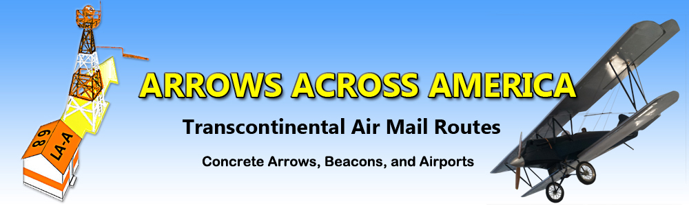
3 Arrows and 18 Beacons |
This site is coming Soon, Check Back to see what new information has been added.
This site provides historical information only, do not use for navigation purposes.
Arrows and Beacons may be on private property, DO NOT TRESPASS!
ALL photos are copyrighted and may not be used without written permission,
other than for personal use.
Arranged by CAM Route and Beacon #. This is a work in progress and will be constantly updated as new information is found.
Arrows have light yellow background.

|
Photo from Google Earth
Yellow outline highlights the arrow shape
|
Arrow and Beacon Photos |
Site Location |

|
Airway Bulletin 376; May 29, 1928
Numedia Airport History
Historical Photo Gallery
(Shows a portion of the concrete arrow in one of the photos. This arrow no longer exists, but beacon & shed are here.) |
C-NY 60A/59B Numedia
Pennsylvania: Columbia County
Transcontinental Airway
CAM #17 Chicago-New York
Cleveland-New York airway
National Air Transport (Inc.)
Gps: 40.865833, -76.401105 |

|
Photos Courtesy of Dave Gurkin and Chuck Gurkin February 12, 2016
|
25 C-P Williamsburg
Pennsylvania: Huntingdon County
CAM #34 Los Angeles-New York
Columbus-Philadelphia Airway
Ebensburg-Philadelphia section
Transcontinental Air Transport, Inc.
Gps: 40.421633, -78.168200
|
 |
|
Shunk #16
Pennsylvania: Sullivan County
unknown airway
Gps: 41.545212, -76.732257 |
 |
|
9A W-C Tuscarora Summit
Pennsylvania: Fulton/Franklin County
9A W-C Tuscarora Summit Web Page |
 |
|
South Mountain
beacon #3 unknown airway
Pennsylvania: Adams County
GPS: 39.906933, -77.436393 |
.jpg) |
|
Altoona-Blair County Airport
Pennsylvania: Blair County
unknown airway
Gps: 40.295953, -78.324448
|
 |
|
Bedford County Airport
Pennsylvania: Bedford County
Cam #11 Washington-Cleveland Airway
Washington-Pittsburgh Section
Skyline Transportation Company
Gps: 40.082088, -78.511828 |
 |
|
Butler-Graham Airport
Pennsylvania: Butler County
Pittsburgh-Erie airway
gps: 40.779259, -79.949122 |
 |
|
Carlisle Airport
Pennsylvania: Cumberland County
unknown airway
Gps: 40.188946, -77.167953 |
 |
|
Chambersburg Municipal
Pennsylvania: Franklin County
unknown airway
Gps: 39.971678, -77.647972
|
 |
|
Connellsville Airport
Pennsylvania: Fayette County
unknown airway
Gps: 39.960673, -79.654293 |
.jpg) |
|
Jimmy Stewart Airport
Pennsylvania: Indiana County
unknown Airway
Gps: 40.632698, -79.100791 |
.jpg) |
|
35 C-P Lancaster DOCILF
Pennsylvania: Lancaster County
CAM #34
Columbus-Philadelphia airway
Ebensburg- Philadelphia section
Western Air Express (Inc.) and Transcontinental Air Transport (Inc.)
Gps: 40.118825, -76.299070 |
.jpg) |
|
Mid State Airport
Pennsylvania: Centre County
unknown airway
Gps: 40.886574, -78.084767
|
.jpg) |
|
Mifflin County
Pennsylvania: Mifflin County
unknown airway
Gps: 40.676984, -77.622783 |
.jpg) |
|
Pocono Mountains Municipal
Pennsylvania: Monroe County
unknown airway
Gps: 41.138358, -75.373991 |
.jpg) |
|
Quakertown Airport
Pennsylvania: Bucks County
unknown airway
Gps: 40.436098, -75.380603 |
 |
|
Rostraver Airport
Pennsylvania: Westmoreland County
unknown airway
Gps: 40.206747, -79.833717 |
 |
|
Somerset County Airport
Pennsylvania: Somerset County
unknown airway
Gps: 40.040380, -79.015781 |
| |
|
Washington County Airport
Pennsylvania: Washington County
unknown airway
Gps: 40.135187, -80.289297 |
.jpg) |
|
York County Airport
Pennsylvania: York County
unknown airway
Gps: 39.922652, -76.878047 |
Arrows were know to be at the following Pennsylvania locations. If the intermediate fields had arrows, it is very likely that the beacons between fields also had arrows.
Happy Hunting. |
Allentown
Allentown Municipal Airport, municipal, rating. Four miles N. Altitude, 380 feet. Rectangular. 250 acres, sod, level, natural drainage; two runways, 2,500 feet N./S. and 2,600 feet E./W., both 200 feet wide. ALLENTOWN on hangar roof. Directional arrow marked "65 C-NY." Pole line along road to E., on part of road to N., and to W.; trees and buildings to N., E., and W. Beacon, boundary, approach, and obstruction lights. Beacon, 36-inch rotating, showing alternate clear and green flashes. Facilities for servicing, day and night. Combined radio marker-radiophone, 278 kcs., for position reporting and emergency broadcasts. Teletype operated by Weather Bureau.
Allentown Airport, commercial, rating . Four miles N. Altitude, 380 feet. Rectangular, 250 acres, sod, level, natural drainage; two runways, 2,500 feet N./S. and 2,600 feet E./W., both 200 feet wide. ALLENTOWN on hangar roof. Directional arrow marked "65 C-NY." Pole line along road to E., on part of road to N., and to W.; trees and buildings to N., E., and W. Beacon, boundary, approach, and obstruction lights. Beacon, 36-ineh rotating, showing alternate clear and green flashes. Facilities for servicing, day only. Teletypewriter operated by Weather Bureau.
|
Bellefonte
Department of Commerce intermediate field, site-53A, Chicago-New York Airway. Four miles SE. Altitude, 1,050 feet. Rectangular, 85 acres, 2,275 by 1,675 feet, sod, slight slope to SE, natural drainage. Directional arrow marked "53A. C-NY." Pole line to S. and SW., radio towers to E. and W., trees to N. Beacon, boundary, approach, and obstruction lights. Beacon, 24- inch rotating, with green course lights flashing characteristic "3" (..._). Department of Commerce radio station WWQ, operating frequency 284 kcs. Radio range beacon, identifying signal "R" (._.), operating frequency 284 kcs. Hangar and aviation fuel, day and night. Teletype.
|
Blain
Department of Commerce Intermediate field, site 28B, Columbus-Philadelphia Airway. Three miles NE. of Blain, Pa.; ¼ mile N. of Andersonburg, Pa. Altitude, 760 feet. Irregular, 53 acres, sod, level, natural drainage; two landing strips, 2,060 feet N./S., 2,580 feet NW./SE., each 500 feet wide; entire field available. Directional arrow marked "28B, C-P" Beacon tower in SE. corner, pole line on E., hill and trees to NW. Beacon, boundary, approach, and obstruction lights. Beacon, clear, flashing characteristic "8" (_...) No servicing facilities.
Department of Commerce intermediate field, site 28B, Columbus-Philadelphia Airway. Three miles NE. of Blain, Pa.; one-fourth mile N. of Andersonburg, Pa. Altitude, 750 feet. Irregular, 53 acres, sod, level, natural drainage; two landing strips, 2,060 feet N./S., 2,580 feet NW./SE., each 500 feet wide; entire field available. Directional arrow marked "28B, C-P." Beacon tower in SE. corner, pole line on E., hill and trees to NW. Beacon, boundary, approach, and obstruction lights. Beacon, clear, flashing characteristic "8 "(_...). No servicing facilities.
|
Brookville
Department of Commerce intermediate field, site 45A, Chicago-New York Airway. One and one-half miles SW. Altitude, 1,400 feet. Irregular shape, 82 acres, sod, level, natural drainage; two landing strips 2,250 feet E/W., 1,250 feet N/S, additional 1,000 feet being conditioned. Directional arrow marked "45A C-NY." Beacon, boundary, and obstruction lights. Beacon, 24-inch rotating with green course lights flashing characteristic "5" (._.). Teletype. No servicing facilities.
Department of Commerce intermediate field, site 45A, Chicago-New York Airway. One and one-half miles SW. Altitude, 1,400 feet Irregular shape, 82 acres, sod, level, natural drainage; two landing strips 2,250 feet B./W., 3,000 NB./SW. Directional arrow marked " 45A C-NY." Beacon, boundary, and obstruction lights. Beacon, green flashing characteristic "5" (._.). Teletypewriter. No servicing facilities. Rotating beacon on hill 1 mile E. Department of Commerce marker beacon, characteristic signal "I" (. ,) operating frequencies 284, 344, and 278 kc.
|
Buckstown
Department of Commerce intermediate field, site 13B, Washington-Cleveland Airway. One mile SE. Altitude, 2,442 feet. Irregular, 56 acres, sod, level, natural and tile drainage: one landing strip 2.300 feet NE./SW.; entire field available. Directional arrow marked "13B W-C." Pole lines on W. and SW., beacon tower in SW. corner. Beacon, boundary, approach, and obstruction lights. Beacon, 24-inch rotating, with green course lights flashing characteristic "3" (. . . ). No servicing facilities.
Department of Commerce intermediate field, site 13B, Washington-Cleveland Airway. One mile SE. of city. Altitude, 2,442 feet. Irregular, 56 acres, sod, level, natural and artificial drainage; one landing strip 2,300 feet NE./SW.; entire field available. Directional arrow marked "13B W-C." Pole lines on W. and SW., beacon tower in SW. corner. Beacon, boundary, approach, and obstruction lights. Beacon, 24-inch rotating, with green course lights flashing characteristic "3" (. . . ). No servicing facilities.
|
Curwensville (Greenwood Club)
Department of Commerce intermediate field, site 48B, Chicago-New York Airway. Six miles N. Altitude, 2,300 feet Rectangular, 37 acres, 2,200 by 900 feet, sod, level, tile drainage. This is a two-way field, longest dimension being N. and S. Directional arrow marked "48A C-NY." Beacon, boundary, approach, and obstruction lights. Beacon, 24-inch rotating, with green course lights flashing characteristic "8" (_ . . , Trees to E. and W. Teletype.
Department of Commerce intermediate field, site 48, Chicago-New York Airway. Six miles N. Altitude, 2,300 feet Rectangular, 37 acres, 2,300 by 900 feet, sod, level, artificial drainage. This Is a two-way field, longest dimension being N. and S. Directional arrow marked "48 C-NY." Beacon, boundary, approach, and obstruction lights. Beacon, 24-inch rotating, with green course lights flashing characteristics "8" (_ ...) Trees to E. and W. Teletypewriter.
|
Du Bois
Department of Commerce intermediate field, site 47, Chicago-New York Airway. One and three-fourths miles SE. Altitude, 1,575 feet. Irregular shape, 60 acres, 1,600 by 1,500 feet, sod, rolling, natural drainage. Directional arrow marked "47 C-NY." Trees to NW. and SW. Beacon, boundary, approach, and obstruction lights. Beacon, 24-inch rotating, with green course lights flashing characteristic "7" (__..). No servicing facilities. This field subject to abandonment owing to airway changes.
|
Emlenton
Department of Commerce intermediate field, site 42A, Chicago-New York Airway. Two and one-half miles NE. Altitude, 901 feet. T shape, 62 acres, sod, level, natural drainage; two landing stripe 2,150 feet NW./SE., 2,875 feet NE./SW. Directional arrow marked "42A C-NY." Beacon, boundary, and obstruction lights. Beacon, 24-Inch rotating, with green course lights flashing characteristic "2" (.._). No servicing facilities.
|
Emlenton
Department of Commerce intermediate field, site 42A, Chicago-New York Airway. Two and one-half miles NE. Altitude, 1,420 feet. T shape. 62 acres, sod, level, natural drainage; two landing strips 2,150 feet NW./SB, 2,850 feet NE./SW. Directional arrow marked "42A C-NY." Beacon, boundary, and obstruction lights. Beacon, green flashing characteristic "2" (.._). No servicing facilities. Rotating beacon located on hill 1 mile NE. of field.
|
Everett
Department of Commerce intermediate field, site 11A Washington-Cleveland Airway. One mile E. Altitude, 1,000 feet. Irregular, 98 acres, 1,800 by 1,750 feet, sod, level, natural drainage. Directional arrow marked "11A W-C." Pole line to E. Beacon, boundary, approach, and obstruction lights. Beacon, green flashing characteristic "1" (.__). No servicing facilities.
Department of Commerce intermediate field, site 11A, Washington-Cleveland Airway. One mile E. of city. Altitude, 1,000 feet. Irregular, 75 acres, 2,900 feet NW./SE., 1,800 feet N./S., sod, level, natural drainage. Directional arrow marked "11-A, W-C." Pole line on E. Beacon on hill one-fourth mile E. of field, boundary, approach and obstruction lights. Beacon, green, flashing characteristic "1" (. ). No servicing facilities.
|
Hartleton
Department of Commerce intermediate field, site 56, Chicago-New York Airway. Immediately NE. Altitude, 1,140 feet. Rectangular, 4"> acres, 1,400 by 1,250 feet, sod, level, natural drainage. Directional arrow marked "56 C-NY." Pole line, buildings, and trees to SW. Beacon, boundary, approach, and obstruction lights. Beacon, 24-lnch rotating, with green course lights flashing characteristic "6" ( . ). No servicing facilities.
|
Mercer
Department of Commerce intermediate field, site 39, Chicago-New York Airway. Four and one-half miles NE. of Mercer, 4 miles SE. of Fredonia. Altitude, 1,300 feet. Irregular shape, 103 acres, sod, slightly rolling, artificial and natural drainage; two landing strips, 2,650 by 650 feet E./W., 2,850 by 700 feet N./S. Directional arrow marked "39 C-NY." Trees to SE. and NW. Beacon, boundary, approach and obstruction lights. Beacon. 24-inch rotating with green course lights flashing characteristic "9" ( .). No servicing facilities. Teletypewriter.
|
Kylertown
Department of Commerce intermediate field, site 50B, Chicago-New York Airway. Adjoins Kylertown on NW.. 7 miles N. of Phillipsburg. Altitude, 1,710 feet. Rectangular, 64 acres, 2,450 by 600 feet NE./SW., 2,450 by 500 feet N./S. landing strip; sod, level, natural drainage. Trees to N. and W. Directional arrow marked "50B C-NY." Beacon, boundary, approach, and obstruction lights. Beacon, 24-lnch rotating, with green course lights flashing characteristic "10" ( ). No servicing facilities. Teletype. Phillipsburg Airport adjoins this field. Facilities for servicing aircraft at Phillipsburg Airport.
Department of Commerce intermediate field, site 50, Chicago-New York Airway. Adjoins Kylertown on NW., 7 miles N. of Philipsburg. Adjoins Ames Airport. Altitude, 1,710 feet. L shape, 60 acres, 2,500 by 2,500 feet, sod, level, natural drainage. Pole line to S. Directional arrow marked "50, C-NY." Beacon, boundary, approach and obstruction lights. Beacon, 24- inch rotating, with green course lights flashing characteristic "10" ( ). Teletypewriter. Department of Commerce marker beacon, characteristic signal "U" (. . —) operating frequencies 284 and 278 kc.
|
McConnellsburg
Department of Commerce intermediate field, site 9B, Washington-Cleveland Airway. One-half mile SE. Altitude, 960 feet. Irregular, 55 acres, 2,320 by 1,420 feet, sod, level, natural and title drainage; entire field available. Directional arrow marked "9B W-C." McConnellsburg on building. Beacon, boundary, and approach lights. Beacon, green, flashing characteristic "9" ( .). No servicing facilities. Teletype.
Department of Commerce intermediate field, site 9B, Washington-Cleveland Airway. One-half mile SE. Altitude, 960 feet. Irregular, 55 acres, 2,320 by 1,420 feet, sod, level, natural and artificial drainage; entire field available. Directional arrow marked "9B W-C.'- McConnellsburg on building. Beacon, boundary, and approach lights. Beacon, green, flashing characteristic "9" ( .). No servicing facilities. Teletypewriter. Department of Commerce marker beacon, characteristic signal "S" (...) operating frequencies 272 and 278 kc.
|
Mercer
Department of Commerce Intermediate field, site 40, Chicago-New York Airway. Four and one-half miles NE. of Mercer, 4 miles SE of Fredonia. Altitude, 1,300 feet. Irregular shape, 103 acres, sod, slightly rolling, tile and natural drainage; two landing strips, 2,650 by 650 feet E./W., 3,050 by 700 feet N./S. Directional arrow marked "40 C-NY." Trees to SE and NW. Beacon, boundary, approach, and obstruction lights. Beacon, 24-inch rotating, with green course lights flashing characteristic "10" ( ). No servicing facilities. Teletype.
|
Newton Hamilton
Department of Commerce Intermediate field, site 27A. Columbus-Philadelphia Airway. One-quarter mile S. of Newton Hamilton, 2 miles E. of Mount Union, Pa. Altitude, 560 feet. Irregular, 91 acres, 2,900 by 1.500 feet, sod, level, natural drainage; entire field available. Extreme care should lie exercised in approaching field. Directional arrow marked "27A. C-P," Newton Hamilton C-P 27A on building. Hill to SW., trees and river on E., beacon tower 1/2 mile W. beacon, boundary, approach, and obstruction lights. Beacon, clear, flashing characteristic "7" (—. .). No servicing facilities. Teletype.
Department of Commerce intermediate field, site 27A. Columbus-Philadelphia Airway. One-quarter mile S. of Newton Hamilton, 2 miles E. of Mount Union, Pa. Altitude, 560 feet. Irregular, 91 acres, 2,900 by 1,500 feet, sod, level, natural drainage; entire field available. Extreme care should be exercised in approaching field. Directional arrow marked "27A. C-P." Newton Hamilton C-P 27A on building. Hill to SW., trees and river on W., beacon tower one-half mile W., boundary (red), approach (green), and obstruction lights. Beacon, green flashing characteristic "7" ( . .). No servicing facilities. Teletypewriter.
|
Numidia
Department of Commerce intermediate field, site 60A, Chicago-New York Airway. One and one-half miles S. Altitude 1,080 feet. Rectangular, 45 acres, 2.061 by 1,700 feet. Sod, level, natural drainage. Directional arrow marked "60A, C-NY." Pole line to N., trees to E. Beacon, boundary, approach, and obstruction lights. Beacon, 24-Inch rotating, with green course lights flashing characteristic "10 "( ). No servicing facilities. Teletype.
Department of Commerce intermediate field, site 59B, Chicago-New York Airway. One and one-half miles S. of town. Altitude, 1.080 feet Rectangular, 66 acres, 1,710 by 805 feet E./W., sod, level, natural drainage. Directional arrow marked "59B, C-NY." Pole line to N., trees to E. Beacon, boundary, approach, and obstruction lights. Beacon, 24-inch rotating, with green course lights flashing characteristic "9" ( .). No servicing facilities. Teletypewriter. Department of Commerce marker beacon, characteristic signal "W" (. ), operating frequencies 338, 284, and 278 kc.
|
Ames Field, Philipsburg
Dedicated AMES FIELD, Philipsburg, Pa., named in honor of the late Charles Ames, prominent air mail pilot who was killed when his plane crashed in a fog in 1925, was dedicated on September 7th with appropriate ceremonies. The airport is located midway between New York and Cleveland, on the transcontinental route. The tract consists of approximately 175 acres, 42 of which have been in use by the Government as an emergency field in air mail operations. There are a 2,000,000 candlepower beacon, boundary lights and illuminated wind cones. The airport has the regulation white circle, airways directional arrow and hangar space for six planes. John B. Rumberger is in charge of operations.
|
Sunbury
City of Sunbury Airport, commercial, rating, and Department of Commerce intermediate field, site 58A, Chicago-New York Airway. On island in Susquehanna River between Northumberland and Sunbury. Altitude, 450 feet. Rectangular, sandy loam and sod, slightly sloping to W. natural drainage. City of Sunbury Field 40 acres, 1,478 by 1,200 feet. Intermediate field 56 acres, 2,150 by 1,050 feet. SUNBURY AIRPORT on hangar roof. Directional arrow marked "58A C-NY." Trees and pole line to W. and SW., sand bar to NE., beacon tower to W. Beacon, boundary, and approach lights around intermediate field, landing area flood light on City of Sunbury Field. Beacon, 24-inch rotating, with green course lights flashing characteristic "8" (_...). Facilities for servicing aircraft at City of Sunbury Airport day and night Teletype.
|
Williamsburg
Department of Commerce intermediate field, site 24B, Columbus-Philadelphia Airway. Two miles W. of city. Altitude, 1,120 feet. Irregular, 60 acres, 2,870 by 1,450 feet; entire field available. Directional arrow marked "24B, C-P" Orchard on N.; trees to NE.; beacon tower and trees on S. Beacon, boundary, approach, and obstruction lights. Beacon clear, flashing characteristic "4" (....). No servicing facilities.
Department of Commerce intermediate field, site 24B, Columbus-Philadelphia Airway. Two miles W. of city. Altitude, 1,120 feet. T shape, 56 acres, 2,870 by 1,450 feet; entire field available. Directional arrow marked "24B, C-P." Orchard on N.; trees to NE.; beacon tower and trees on S. Beacon, boundary, approach, and obstruction lights. Beacon clear, flashing characteristic "4" (....). No servicing facilities.
|
|
Alabama | Arizona | Arkansas | California | Colorado | Connecticut | Delaware | Florida | Georgia | Idaho | Illinois | Indiana | Iowa | Kansas
Kentucky | Louisiana | Maine | Maryland | Massachusetts | Michigan | Minnesota | Mississippi | Missouri | Montana | Nebraska | Nevada
New Hampshire | New Jersey | New Mexico | New York | North Carolina | North Dakota | Ohio | Oklahoma | Oregon | Pennsylvania
Rhode Island | South Carolina | South Dakota | Tennessee | Texas | Utah | Vermont | Virginia | Washington | West Virginia | Wisconsin | Wyoming |
|
|